Gibraltar Mountain, looming above scenic Santa Barbara, is often called the Mont Ventoux of America for its steep, dramatic switchback ascent and gorgeous views of the landscape below. (FYunculturedI: Ventoux is a mountain in the south of France.) Of course, me being me, this is where the bumps in the road begin.
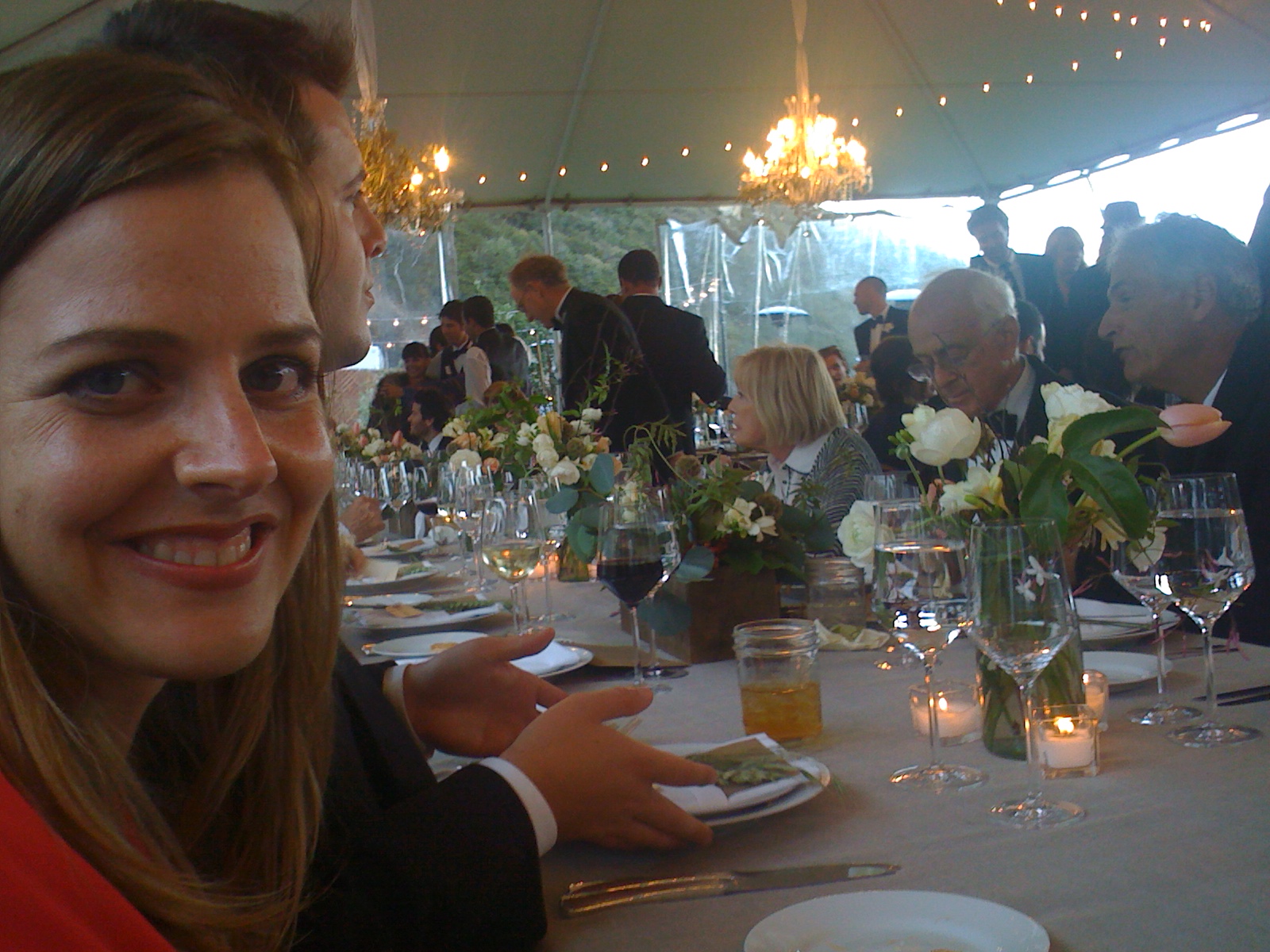
I was staying at the posh Montecito Inn (Charlie Chaplin-themed hotel, pretty cool) with my special something for a weekend wedding. The rehearsal dinner was at the Four Seasons the night before--very fancy--but I moderated my alcohol intake for the sake of the morning ride, because my priorities are fucked. That night, I dreamed of clear views of St Barbie and the Channel Islands, maybe a few blue whales flopping around in the channel for my amusement.
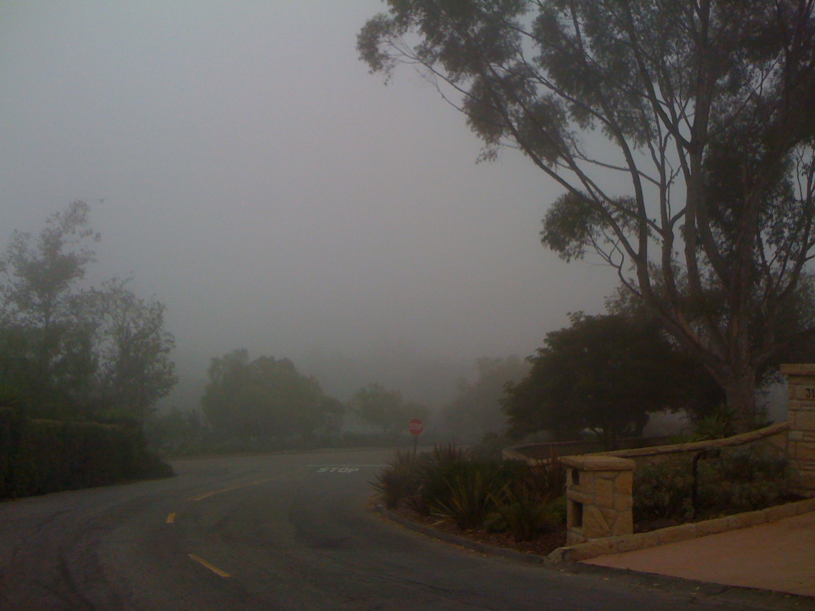
I woke up early, but not bright. The weather was dark and raining, about 55 degrees, very atypical Southern California weather in July. Nevertheless, I rode my way up into the mist above Santa Barbara, to the base of fabled Gibraltar Road.
No views from the base of Gibraltar today.
Once inside the clouds, I was reminded of a visit to Crater Lake that Brian Dolen and I made on a road trip to Bend and Mt Hood. I think the photos below demonstrate what we did not see.
Nothing to see at Crater Lake.
Same place, clearer day.
Crashed trucks littering the road to Bend.
That blizzard in Oregon wasn't a total loss, though; we learned that most trucks suck at bumper cars.
Having never taken Gibraltar Road, I didn't know how long or steep the road really was, and couldn't see more than 30 feet ahead for the first 30 minutes; I was just pedaling through the fog hoping I didn't meet a car head-on. After a long period spent inside of clouds, I came up into Rattlesnake Canyon, and my whereabouts became a little more clear.
Coming up into the sun.
Soon, I'd reached the tops of the clouds.
Above the clouds...
And figured out I was only about halfway up.
Looking back toward the Pacific, nothing but clouds below.
After a while, I made the top of Gibraltar, and continued west onto Camino Cielo toward La Cumbre Peak, the tallest of the Santa Ynez Mountains at 4000 feet. (Cumbre is brown-speak for 'peak', so properly translated it's The Peak Peak.) It was getting hot above the clouds, but I had this song from my childhood playing in my head:
Rather than descend back into the fog and stormy St Barb from The Peak Peak, I retraced and went east on Camino Cielo, which straddles the top of the Santa Ynez Mountains and offers views off of both sides.
Camino Cielo.
According to the Google Map I'd studied, I could take Camino Cielo east all the way to Romero Canyon, and descend back to the coast, then ride back west toward Montecito, making a big loop. Naturally I get going about 40 miles an hour along Sky Road when suddenly, after rounding a corner, I unexpectedly barrel onto a single-lane dirt road... I'm still writing this, so I didn't die or anything worse, but it was quite a test of balance and skill braking from 40 to zero, on dirt, with a cliff off to one side, on 1/2-inch wide, slick road bike tires. Google Maps doesn't show it, so allow me to inform you: Sky Road ends very abruptly and Romero Canyon is unpaved.
Abrupt change in road surface noted.
Oddly enough, I looked up to catch some breath and thank The God(s?) for not going over a cliff when I noticed vultures circling above me. I'm guessing they knew these roads (and where they end suddenly) better than me, and had previously profited from it.
Vultures: pretty from far.
I couldn't really make too many more wrong turns and still make the wedding on time, so I retraced my way back up to where Camino Cielo crosses Gibraltar Road, and bombed back down into the clouds from whence I rose.
During my ride up in the sun that day, I could often hear rattling when I would coast along--not unusual, since a ticking freewheel sounds a lot like a rattle. But something else was rattling at times, too. I think they were responding to my back wheel's mating call. And since I'd climbed Rattlesnake Canyon, I knew some serpientes were probably about.
Naturally I ran over a rattlesnake on the way down. There was no way to see it while dodging potholes on the descent, but I felt it, and by the time I'd come to a stop about 100 feet down the road, I could see it back up there, coiled to strike. The snake was fine, because within seconds it darted into tall grass. Snake in the grass... I wasn't chasing it.
Rattler not to scale.
The rest of the ride was uneventful. I never got any ocean or Santa Barbara views, just cloud-tops, then cloud interiors, then cloud-bottoms, which explains why these photos are so mundane and only a bit scenic.
The wedding was eventful, at The Ranch north of Santa Barbara, near where Michael Jackson used to live. I think Poppy got some ideas. Oh no.
Oh no.
Haze, clouds, fog, rain, precipitous cliffs, Biblical symbols and flashbacks... This ride could have been one grand metaphor for my own mental state. But it's not.


No comments:
Post a Comment